Envirosite is a leading provider of environmental data solutions for due diligence and risk management. Offering real-time access to over 2,200 comprehensive databases.
Property Risk Map
Search, Locate, and Assess Your Environmental Property Risk
Property Risk Map
What Environmental Risks Surround Your Property?
Watch the video. Discover your risk.
Share:
Supporting the following UN Sustainable Development Goals:


Key Features
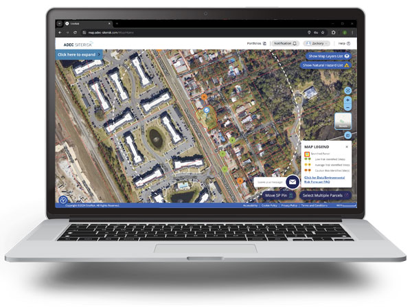
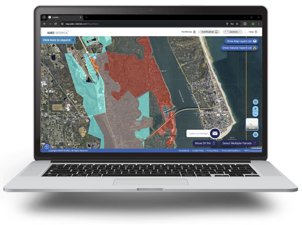
The Property Risk Map offers an intuitive, interactive mapping tool that provides real-time visualizations of environmental and property-related risks across various locations. Equipped with comprehensive data integration, this product enables users to identify, analyze, and understand potential hazards, ensuring informed decision-making for property investments and management.
Risk Clarity
Data Precision
Time Efficiency
Asset Protectiion
Strategic Insight

Evaluate Your Property's Potential Environmental Risk
The Property Risk Map is a wide-ranging tool designed to evaluate and present potential environmental risks associated with a specific property or area. This tool allows users to search through vast databases, often encompassing millions of records from over 2,200 sources, to identify potential hazards, liabilities, and opportunities related to a subject property. Such risks can range from environmental concerns such as brownfields, superfund sites, natural hazards, and flood zones to other influential factors like pipelines and federal wetlands. By understanding these risks early in the transaction process, stakeholders can make informed decisions, mitigate potential issues, and strategize for sustainable and resilient development.
Transparency into Your Property Risk
Having a robust understanding of potential risks associated with a property is extremely beneficial. Utilizing a property risk map offers industry professionals a competitive edge, ensuring informed decisions and optimized outcomes.
- Informed Decision Making: Gain a holistic view of potential environmental risks, allowing for better assessment and strategic planning.
- Cost Savings: By identifying potential risks early, professionals can avoid costly remediation and legal challenges, ensuring a more profitable transaction or development.
- Proactive Risk Mitigation: Identify and address potential hazards early in the transaction process, enabling proactive measures to reduce liabilities.
- Competitive Advantage: Stand out in the market by showcasing an understanding of property risks, attracting more clients
- Strategic Development Planning: With insights into factors like brownfields, flood zones, and pipelines, professionals can strategize for sustainable and resilient development, maximizing returns on investment.

“I started using the Envirosite database service in 2021 and have had great service and communication with their staff, they have been very professional and helpful.”
- Raj Chopra
Owner, Advanced Contracting Services, Inc.
An ADEC Innovation
ADEC Innovations is purpose-driven provider of Global Business Services solutions that advances sustainable business and operational practices by transforming risk into positive impact and value.
OTHER ADEC INNOVATIONS
- 2026 © Envirosite Corp.
- 56 Broome Corporate Parkway, Conklin, NY 13748
v2.0.0 (e1f90909)


